Nakusp – Balfour – Creston – Grand Forks

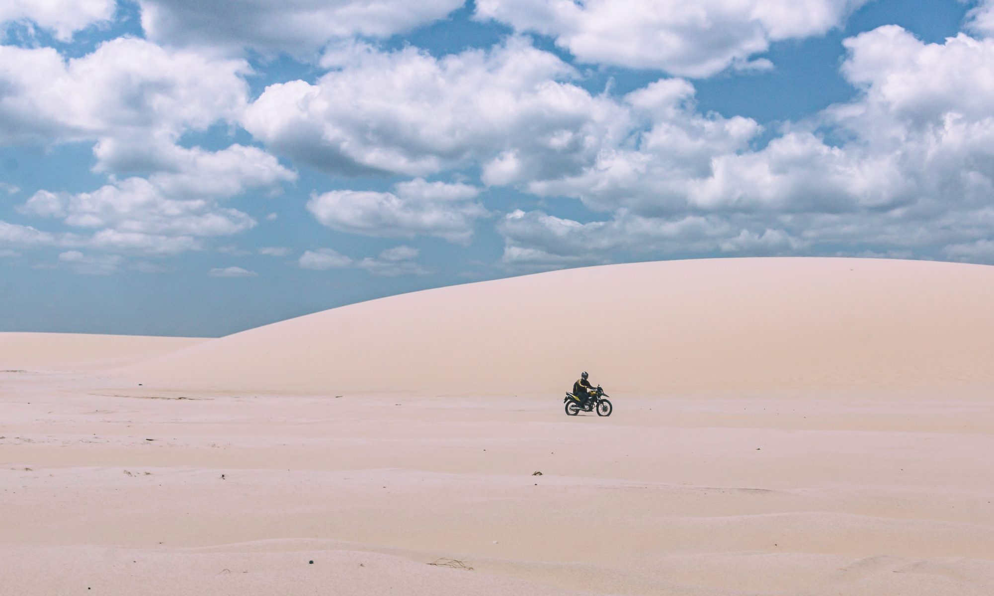
I road out of Revelstoke south on 23 towards the ferry at Shelter Bay in good spirits – no thanks to my back but to the weather I was riding towards to the south and the overall forecast for the next several days. Sunny and warm! I also was excited for the loop I was about to ride. I had ridden much of the route last year but it was in the rain for the majority of the day. Wet roads require much slower speeds anyway…plus the overall tension I personally experience riding twisty wet roads – thinking the back end is going to cut loose at any moment, you get the idea.

Last year we had to wait almost 45 minutes to load the ferry at Shelter Bay but this year I pulled up and the lines were already moving forward to load. This ferry station has nothing else there where some of the others have some commercial activity at dock. I remember distinctly the coffee and delicious fruit tart I had at the Balfour ferry station last year and was looking forward to the same treat this year. They bunch up all the motorcycles together on the ferry so there is time to chat it up with fellow riders. Many of the guys on this ferry were going to be doing a short day and staying in Nakusp. We stopped for lunch last year in Nakusp and it is a really cool little town so was planning the same this year. After a 30 minute or so chug across the lake I rode off the ferry south on 23 with blue skies and cool perfect temperature. What a great day to be riding in BC!

Arriving in Nakusp right at lunchtime I parked and walked into Chumley’s for lunch. I knew the food was good having chosen the same lunch spot last year. Several other bikers were there and were camping in the municipal campground and were talking about what a good time they had last night socializing with all the other bikers and travelers. Nakusp is an annual site for a Horizon’s Unlimited meet each year in July and the that campground is taken over by attendees during the long weekend event. This year it was held a little earlier or I would have tried to attend. I have attended Horizon’s meets in Virginia and North Carolina where Ken and I were presenters on our trips around the world and to Ushuaia. After lunch I was convinced to cut my day short and spend the night in Nakusp. I’m glad I did…the campground was packed with bikers and travelers from all over the world. It was a great night socializing and making new friends.

Sunday morning I rolled out of my tent barely able to straighten up. I took a walk to try to loosen up before packing up my camp. After the walk I made coffee and did the daily safety check on the motorcycle. Today I noticed a new oil leak (I have had a permanent leak from a crack in the oil sump for 5 years now) coming from the rear shock. I’ve had that shock rebuilt once already but that was now 16,000 miles ago so appears it is due again. Hopefully it doesn’t get any worse. I may have to avoid off-road for the rest of this trip to preserve it. My camp pack up routine usually takes about 30-40 minutes but now moving as slow as I am it is taking well over an hour. Very frustrating…it’s been 5 days now since I tweaked it. The longest previous back episode lasted about 10 days or so – hoping I will be back to normal soon.

Despite my back misery and the discovery of the rear shock leaking, I was in a great mood because it is sunny, warm and I was going to ride 31A on dry roads! I reached the turnoff and switched from the Coffee Break Spanish podcast I was listening to and went to music. What a blast it was dancing through the turns! I almost turned around and rode it again it was so fun, but instead started thinking about the bakery in Balfour and a fruit tart.

I arrived to the Balfour ferry dock to already crowded lanes, got off the bike and started taking off my Helmut when the cars in front started moving forward. I glanced up at the sign and saw that I had arrived just as the hourly ferry was loading to make the run across the lake. Rats! No fruit tart for me! I couldn’t believe that both ferries this year were blindly timed with a zero wait. I couldn’t justify wasting any of this beautiful day waiting for the next ferry so boarded right away. More riders to chat it up with again on this ferry. I tend to draw the attention of other riders with my not so pretty 25 year old pig of a bike. Most everyone else I run into are on much newer BMW’s, Harley’s, Honda’s, etc. Part of me would love to have a newer bike but honestly this one still does the job and I don’t really have to worry about anyone messing with it once parked for the night. Much more inviting motorcycles are always parked near me so I know thieves will never be drawn to mine.

Rolling off the ferry I headed south on 3A towards Creston. Last year I spent two nights in Creston and remembered a good Indian restaurant in town that I was targeting for lunch. Unfortunately, when I arrived to town and pulled up in the street next to the spot, it is closed for lunch on Sundays. I’m striking out on food today! So instead I gassed up, hit a grocery store and bought a couple of the vegetable curry pastry triangles (I think they are called Samosas) you find in groceries all over Canada. They really are good but probably not as good as lunch at the restaurant would have been.

After Creston I continued east on Highway 3 to Grand Forks. After 3 nights in a row camping my back needed a break so I got a room at Johnny’s Motel on the river at the edge of town. I was blown away when I walked into the room after checking in. It looked like a brand new model room. Later while in town having dinner, I found out why it was so new. The entire town had experienced a 200 year flood in May of 2018 and Johnny’s Motel was under water. It had been completely redone and had just re-opened earlier this summer. I can’t even imagine the amount of water that it took to overflow the banks of the rivers (the Granby and Kettle Rivers confluence in Grand Forks) – the river bank next to Johnny’s is at least 25 feet up from the river at it’s current flow! The motel was opened by Johnny in the 50’s and has changed hands several times over the years but has kept the name. At one time it was owned by an Englishman and the tribute to England is still displayed proudly out front as can be seen in the picture included in this post.

Today I am heading east to Cawston to visit Cynthia, Vanessa and Rosie. I stayed at Cynthia’s last year on the way up and got to meet her friends Vanessa and Rosie. Then met up with them again on the way down and camped out in Creston with them. I originally met Cynthia in Panama on the trip to Ushuaia. She is planning to leave on her own trip to Ushuaia this fall. They are all really good people and I’m looking forward to seeing them again today!

Icefields Parkway

I got a late start out of Prince George Wednesday morning. My back is really acting up again so the packing process is getting quite slow. I twist or turn the wrong way and the result is super sharp pain in my lower spine. I made the spontaneous decision while packing up to head down the Yellowhead towards Jasper. It’s about 400k to the park entrance and a really pretty ride. By the time I got to the park entrance, it was late afternoon so decided to look for a strategic place to camp to hit the Icefields Parkway early the next morning. I found a campground on the Robson River and slowly set up for the night. I’m trying to be as careful and as possible on my back. Just getting on and off the bike, moving my left leg to shift, etc. is difficult and awkward. It had cooled off to a perfect evening temperature by around 7pm. I haven’t used the camp chair I have carried along for over 8,000 miles now but tonight was able to put it to use. I hiked to a nice spot downriver with my iPad and read for a couple of hours listening to the soothing sounds of moving water. The days are getting shorter as I head south – the sun is setting around 9pm now. Just a few weeks ago it was straight up daylight until almost midnight. I prepared for a cold night and morning as temps are forecasted in the high 30’s/low 40’s. I have a sleeping bag liner that gives me a few degrees below what my 35 degree bag offers. This year I have a better sleeping pad with higher R rating than the one last year so not getting the cold coming up from the ground that I was getting last year.

I packed up and got moving early Thursday morning, paid my park fee and was on the parkway by 8:15am with very little traffic. I was geared up and plugged in due to the cold temperatures. Jasper is a really beautiful park with glaciers receding down tall mountain peaks. Like in Alaska and everywhere else on earth, the glaciers are slowly disappearing. Better get out and see them while you still can. I made more stops than usual just to get off the bike ands stretch my back. I really tweaked it good and it’s getting more and more difficult to ride and function. Sleeping in a tent probably isn’t helping it any. I picked up some more icy hot back patches in PG but they don’t seem to be helping much.

After a late lunch I turned off onto highway 1 through Yoho National Park towards Golden. I was hoping for a bed at the Kicking Horse Hostel but they were full so I settled for a campsite at the municipal campground in town. It was a nice spot on the Kootenay just upriver from the confluence with the Columbia – and walking distance to the Wolf Den for a beer and dinner. I met some really cool people at the Wolf Den – backpackers, hikers and mountain bike enthusiasts in Golden for the launching spot that it is for all these outdoor activities. It was raining a bit when I left the Wolf Den so glad I had set-up camp earlier. It rained lightly on and off all night which produces a nice sound on the tent fly to sleep to.

The next morning was clear and and dry so I waited a bit for the sun to come up and dry everything out before packing up. I once again rode through Glacier National Park of Canada (3rd time now) but this time could actually see the impressive mountain peaks popping in and out of the clouds. It’s really a pretty ride between Golden and Revelstoke and on my 3rd try, I finally got to see something other than low clouds and fog. I arrived into Revelstoke around 2pm and rode around town looking for a lunch spot and settled on the Village Idiot (great name!) for a late lunch. After procrastinating for almost 2 hours at the restaurant, I decided to look for a place to stay the night. Unfortunately, Revelstoke is expensive! I couldn’t find anything under $100US so decided to camp again. Probably not the best for my back but good for my budget. The first two campgrounds I checked were already full for the night but the 3rd had spots available. The tent spots were tight and I barely had room for a tent and my motorcycle. It was still early so decided to take a long walk around town to see if it would loosen up my back. After walking almost 3 miles I still felt sore so broke out the mat back at camp and tried some more stretching. Nothing seems to be working – in fact it feels like it got worse since I got off the bike 6 hours earlier. I really need to step it up on the Pilates once I’m back to normal and try to increase the strength in my core.

This morning I am at Starbucks (Tim Hortons was slammed busy!) drinking coffee and using the wifi trying to decide where to go next. Thinking to make a run down 23 to Shelter Bay and take the ferry across the lake, run down to Nakusp (hip little town) for lunch and then hit 31A over to Kaslo. I ran this route last year and it was a good ride. 31A is a twisty road connecting Slocan and Kootenay lakes. Hoping my back hold up for the day. It was hurting bad this morning so downed a few Tylenol even before packing up camp. It feels a little better now but if I twist or move in the wrong way I get that sharp pain in my lower spine. It’s really pissing me off a bit at the moment and I’m not sure what I can do. I will probably try to find a bed tonight if I stumble upon a reasonably priced motel. So far the weather looks good so there is that to be happy for!

Cassiar

The ride from Tok to Whitehorse was cold and a bit drizzly but could have been worse. All day the skies were dark and threatening to the westerly direction I was headed and I was sure I would get wet. I think I timed it right as it seemed the roads were wet from recent rain but had stopped just a short time before. When I arrived in Whitehorse it was a bit cloudy but warm and dry. The B&B was located a bit outside the downtown areas – but was a walkable 20-30 minutes. I don’t mind a good walk after being on the bike all day. Whenever possible, I try not to get back on the bike after arriving to my destination to intentionally get some needed movement in the legs. The B&B is self service in that the owner isn’t there and the guest self manage. Door code to get in…self service coffee, tea, milk, cold breakfast items, etc…a washer/dryer you could use but only between 4-8pm. I was able to get all my camping gear out on the deck to dry, dirty clothes washed and all electronics charged during my short stay. I met Bjorn, also staying at the B&B, a fellow motorcyclist from Vancouver riding up Tuk on a Super Tenere. We shared riding stories and had some good kitchen table conversation over cold beers. There was also a couple from Alberta traveling by car and a couple from Calgary who had flown in for the weekend. The house had 6 rooms, 2 bathrooms, laundry room, kitchen, living room, dining room and a large back deck. Not a bad stay and one of the cheapest options in Whitehorse at $95 CAD.

The next morning it was a chilly 45 degrees when I left Whitehorse. I plugged in the liner and broke out the winter gloves. It was sunny so by noon or so it had warmed up into the high 60’s. I only stopped once (for gas) the whole ride to Watson Lake. Stopped by the signpost forest to snap a few pics and add the Colorado plate off my long gone Subaru to the collection. The sign post forest is a collection of street signs, town signs, license plates, homemade plaques, etc. donated by travelers passing through on the road. Before the Cassiar was completed all traffic coming north had to come through Watson Lake. It was started by a US soldier who was injured and staying in Watson Lake while working on the Alaska Highway project in 1942. His commanding officer assigned him to repair and erect directional signposts, and while completing the job added a sign that indicated the direction and milage to his hometown in Illinois. Others followed suit, the trend caught on and today there are over 77,000 signs in the forest.

I gassed up, filled my water bottles and headed down the Cassiar to camp and Indian Creek. It’s a free campground with pit toilets and sites with fire rings and picnic tables. I camped there on the way up and down the Cassiar last year so very familiar with the spot. There were a couple of RV’s there but I was the only tent camper. The overnight temps are getting colder and that night/early morning was in the low 40’s and beginning to test the limits of my camping gear for cold temps. I’m probably good down into the low to mid 30’s but not much colder than that. It should get warmer as I head south.

The next morning I packed up camp and made my way down the Cassiar. I’ve decided that overall I like the Cassiar a bit more over the Alcan. The Alcan has some good good scenery between Fort Nelson and Watson Lake but is relative straight. The Cassiar is much more interesting in terms of twist and turns and ups and downs. The roadway is also much more narrow on the Cassiar with no shoulder. The brush comes right up to the road in many sections so wildlife awareness takes priority. I made a stop at Jade City for the free coffee and have a look around the gift shop. Jade City is not actually a city but a roadside stop on the Cassiar. They have a jade mine up in the hills and do all the cutting and polishing down in Jade City. The place actually has a reality TV show on the Discovery Channel called Jade Fever that is filmed there. I saw a bunch of hipster looking people walking through the compound to cabins with professional looking cameras so assume they were part of the film crew.

Again it warmed up into the mid 60’s and was sunny and nice when I arrive to Dease Lake. Last year I camped at Dease but this year decide to grab a room at the Northway Motor Inn, the only hotel option in town. Since it was such a nice day and early, I pulled the gear and boxes off the bike and made a run up the dirt road to Telegraph Creek. I ran the road all the way to the town of Telegraph Creek last year but this time only wanted to run out about 3/4 of way to get to the viewpoint over the creek as it runs through a small canyon. The road was dry and mostly in great shape outside a few short sections. It was about 40 miles out to the overlook, I snapped a pic (featured pic on this post) and rode back to Dease Lake. There was lots of bear scat on the road but didn’t see single bear – or any other wildlife for that matter. Back at the hotel there were 6 other bikers who had arrived and we all ended up standing around in the parking lot talking motorcycles and drinking beer until dark.

Clouds to the south backed weather forecasts that called for rain all along my route south on the Cassiar. I hadn’t decided if I was going to to run down the 37A to Stewart/Hyder or just skip it as I made it down to Bell II around mid-day. It had been sprinkling on and off all morning but so far nothing big. Coming out out of Bell II, I saw one bear in the road off into the distance that disappeared in the bush before I arrived to the spot and another that was just off the road as I rode by. I arrived at Meziadin Junction to fuel up around 2pm and looking down 37A it looked dark and stormy in the direction of Stewart. I chatted with some folks at the store that had been to the Hyder ranger station earlier that day and they said no bears that far up the creek yet. Rats! That was going to be a good chance to see a grizzly. The salmon come upstream to spawn and the bears have a feast every season with prime viewing from a ranger station and boardwalk above the river. Last year I came through for the second time a couple of weeks earlier in the season and there were lots of salmon, but no bears. I was hoping the timing worked out this year but appears again I am too early to see the bears. I decided to continue on down south and get to see 3 more black bears immediately after pulling out from the gas station. I think I was able to get them recorded on my helmet cam. Then, less than 10 minutes later, it happened! A grizzly just off the road popped its head up and then rose up on its hind legs from the low brush just 20 feet or so off the road as I was driving by. So excited to have finally experienced a grizzly in the wild from a close but safe range! Hope to never encounter one on foot in the wild. It was huge!

I grabbed a room for the night at a motel in New Hazelton – a place I had stayed twice last year. Nothing much to look at from the outside but really nice updated rooms and a friendly owner. The rain had held off for most of the day until I rolled into the town it started up. As I was unloading gear at the motel it started to rain pretty hard. It ended up raining most of the night so glad I didn’t even attempt to camp. I took my time the this morning as it was still raining. Glad I waited because I had wet roads but no rain falling from the sky almost the whole ride to Prince George. It started to sprinkle coming into town and then started pouring as I made my way across town in rush hour traffic. I grabbed a room at the North Star Inn – one of the seeder looking hotels in PG from the outside with fairly decent remodeled rooms on the inside. It’s right across the street from a large grocery store so I can reload on camping food supplies. Tomorrow I’ll see what route has better weather. My choices are to turn south down 97 towards Vancouver or continue southeast on 16 towards Jasper and Banff. Choices, choices…

McCarthy Road

As I arrived to the turnoff for Alaska Route 10 to Chitina and the start of McCarthy Road it was already raining lightly and it looked dark and very iffy to the east. It’s about 17 miles to Chitina and then about 60 miles on the gravel/dirt to the town of McCarthy. I was debating if I should wimp out due to the rain and uncertainly of the road condition when wet. After the episode on the Canol – dropping the bike and having to deal with getting it back upright by myself, I’m having negative thoughts. This road should have more vehicles due to the attraction of visiting McCarthy and the Kennecott Mines, but I actually wasn’t sure what to expect. The DR650 I rode up here last year was probably 250 pounds lighter the this 1100. I could just pop off the duffle off the tailback and fairly easily get it back up by myself. My back is finally starting to feel better and I don’t want to screw it up again.

I decided to run to Chitina and go from there. When I got to Chitina I decided to go for it and headed out into the light rain. The speed limit on the road is 35mph and honestly probably went even slower through most of it as there are many very sharp turns. I never really lost traction but certain spots looked slick and much of it was very rough with washboards and potholes. The potholes are a bit hard to judge when they are full of water. I took some pretty good hits that I wasn’t really ready for. I decided to stand up to better balance out the suspension. Soon the rain let up a bit and had periods of sunshine peeking through the clouds. The Kuskulana River Bridge most definitely got my heart racing and adrenaline flowing. It’s over 100 years old, 775 feet long and vertigo inducing 238 feet above the bottom of the gorge. I was glad to be over it but already thinking about having to go back over it again on the way back.

I made it to the end of the road, parked the bike and hiked into town across the footbridge. The bridge for vehicles is private and only can be used by residents of the town. I grabbed a coffee and ate a couple of bananas I bought earlier and made off for the return trip to back to Highway 4. The bridge was just as scary the second time but I focused my vision forward this time so was able to keep a better line with the bike. Still was glad again when it was over. I continued on enjoying the winding and undulating track when in the smooth sections and cursing it when it returned to the washboarded and potholed rough sections. There has definitely been more vehicles on this road but I only ran into one motorcyclist on a KTM 990, originally from Argentina but currently living in LA. He was heading out to McCarthy as I was coming back but we both stopped to chat for a bit.

Six hours after making the right turn onto Route 10, I was back at the same spot, this time turning right to head north. I really enjoyed this ride and glad I went through with it. All the dirt tracks I have ridden in Alaska and the Yukon come with incredible scenery with each having its own identity and its own version of naturally created beauty. McCarthy is more like the Canol than any of the others I have ridden. Both McCarthy and the Canol are pretty narrow with zero shoulder and have long sections through thick forest and tall brush areas. I didn’t see a single wild animal out or back on McCarthy Road but expected something to jump into the road around every curve. On the Canol I saw several Moose and Deer and a one bear. McCarthy should be a can’t miss for anyone on a proper bike with tires that can handle some dirt. It’s an extremely remote area in an already remote state so be prepared. As I turned north, I knew I had another decision to make in about 30 miles.

The Tok Cutoff is the most direct route back to Tok. The longer way is to continue up Highway 4 and then drop back down the Alcan. It is roughly double the distance to go around but on decent chip seal and tarmac. I had heard from several other travelers that the Tok Cutoff was totally destroyed and they had hated every minute of the trek. The guy I talked to the other day said he would absolutely go around if he had to do it again despite the two extra hours of travel. It looked dark and raining up the Cutoff so decided to keep heading north and go around. 20 minutes later I came around a corner into a wall of low dark clouds. I pulled over to gear up and get my heated liner and controller out as I was about to get wet and cold. Just a few minutes later it started to rain and didn’t stop until over 3 hours later – about 25 miles north of town. At times it was pouring and I had a hard time keeping my shield from fogging so I had to keep the speeds down.

I arrived in Tok a little after 9pm and after stopping for another salad bar at Fast Eddy’s, headed to Thompson’s Eagle Claw Campground to spend the night. I hoped there would be one of the eclectic structures available so I didn’t have to pitch a tent. I dried out a bit in the last 15 miles but not completely. The jacket and Helmut were super damp when I put them back on after dinner. I pulled in and did a loop through the camp and found it deserted so had my pick of anything. There is a tent cabin, and a tepee – dry, but both would let in mosquitoes so I would have to burn the provided coil stick repellents. There is a converted ambulance that was sealed enough to keep the bugs out – but that seemed like a bad omen so passed on that. There is a private little cabin, but $40 – the most expensive option. All the other shelter options are $25 except the bunkhouse cabin and school bus bunkhouse with both communal and $15 per bed. I chose the bunkhouse cabin knowing I would have it all to myself for only $15. The small cabin had two bunk beds, a comfortable couch and a little propane heater.

As I opened the left box with my camping gear, I found the inside soaking wet. It seems that I had closed the top hatch on top of the metal zipper for the lid bag leaving a gap in the rubber seal that faced forward. The rain had made its way into my pannier soaking everything. I took all the soggy gear out and poured an inch of water out of the box. Now I was even more grateful I had a roof and some heat. It was still full on daylight at 10:30pm despite the overcast skies. I started reading hoping my sleeping bag would dry to a bit – and after 2 hours it did not. It was almost 1am so I climbed into the wet bag and fell asleep to be awakened by rain on the metal roof about an hour later. It ended up raining on and off most of the night and into the morning so I’m glad I didn’t have to pitch a wet tent on top of sleeping in a wet bag.

This morning I woke up early and took my time getting packed while enjoying some camp stove coffee. Since it was raining and cold I was in no hurry to get back on the bike. I didn’t end up riding away until almost two hours later and decided I was going to head back towards the border and the Yukon Territory. The constant rain in Alaska is taking it’s toll on my mood so I think I need to try to find some better weather.

I’m now at Fast Eddies grabbing a quick bite, double checking weather forecasts, and accommodations down the trail and updating the blog using their wifi. I just booked a room at the Wild North B&B in Whitehorse – a hostel type place where you get your own bedroom but share bath, kitchen and living areas. It had received good reviews and was the cheapest option in Whitehorse. It’s not raining at the moment but looks like it could start again any time. The temp is only in the low 50’s at the moment and forecast to barely reach 60. It was aparently in the low 40’s last night. Seems the summer is coming to an end up here in the north as the highs and lows forecasted in the region are low 60’s and low 40’s. It’s probably a 6 or 7 hour ride I have ahead of me but all on the Alcan.

Denali Highway 2.0

It was raining again when I left Fairbanks and since every direction looked ominous I decided to jump back on the 3 and head south again. The weather forecast said no rain today in Anchorage and rain all day in the Fairbanks area but I’ve found the forecast up here to be highly inaccurate. I didn’t get to see much on the way up the 3 and the way back down was more of the same. Low clouds were stuck to the mountainsides like glue. Very disappointing as there are impressive peaks off this highway…like Denali (formally Mt McKinley) – the highest peak in North America at 20,156 feet. Obama (rightfully) officially approved renaming it Denali in 2015. Denali is also the third most isolated peak on earth after Mount Everest and Aconcagua in Argentina. But once again, Denali was buried in the clouds somewhere off in the distance.

The clouds were beginning to break up a bit to the south as I passed the park entrance and touristic area. I reached Cantwell and while filling up with fuel made a game time decision to hit the Denali Highway again – hoping for better weather and visibility this time around. As I turned east it didn’t look great at all. But after riding about 10 miles I could see the clouds starting to break up even more. Then the sun actually came out! The next three hours I was in heaven enjoying this amazing landscape. Ancient glaciers had cut through the space leaving marshy grasslands, rivers, streams and lakes. The glaciers are still in existence and receading up the mountainsides off in the distance. The contrasting colors of blue, green, white and rust made for an eye pleasing experience. Since I had just ridden this stretch from the other direction I didn’t have the usual hesitant/negative thoughts I get when riding a new remote dirt track by myself. I just was able to relax and enjoy the ride and space I was in.

Alas, all good things must come to an end it seems – just as I got off the Denali to Highway 4 the clouds were closing in again. Both directions were the same so I chose south towards Valdez. After about 15 minutes of riding south I was again getting crushed with rain and high winds. As I approached the Tok Cutoff I debated heading back to Tok but decided to continue south instead. I got to the turnoff for Alaska Route 10 which hooks up with McCarthy Rd in Chitina. I want to ride out to McCarthy as it is supposed to be an amazing ride to the remote town of McCarthy and the old Kennecott Mine, which is a National Historic Landmark. But on a wet day like today, and late in the afternoon was not the time to attempt this so I continued south to Valdez. As was the case in Anchorage, there are no cheap accommodation in Valdez. I settled on a campground just north and got set-up just before it started raining again. I spent the night in my tent reading until it got dark around 11:30pm. It would rain on an off the whole night which is a pleasant sound to sleep to in a tent.

This morning it was still sprinkling a bit as I packed up so everything in my boxes are now wet too. I keep one side box for the wet stuff and the other side I try to keep dry for electronics and such. I rode back down into Valdez to see what there was to see and ended up grabbing breakfast at a deli near the docks. Valdez is actually quite a scenic town with mountain peaks surrounding the inlet – and is where the Alaska pipeline ends. I’ve now been to the start of the pipeline in Prudhoe Bay where oil is extracted from the oilfields and now the end of the line in Valdez where the oil is shipped out. Someday hopefully the whole process will become obsolete with renewable energy supplying our needs.

I’m here now at the deli using the free wifi and plan to head out to McCarthy. Probably won’t stay overnight there as it is expensive so it should be about 5 hours round trip out and then back to Highway 4. Still hoping to see a Grizzly at some point – from a safe distance!

Alaska

I did decide to take a short day and arrived at the Thompson’s Eagle Claw Campground in Tok, AK at around 2pm and after a quick salad bar lunch at Fast Eddy’s in town. There were only two other bikers (3 people) in the camp when I arrived – a guy from Indiana and a couple from Australia/New Zealand riding 2-up. They had arrived the night before and were taking a layover day doing maintenance on their bikes. Thompson’s Eagle Claw has a nice stocked shop area for bikers to do maintenance on their bikes. I needed to drain some oil from out of my bike at some point (overfilled it a bit in Whitehorse), but that could wait until later. It was a nice day so I quickly set up camp and went for a hike around the area to hopefully stretch out my legs and back. Usually riding doesn’t bother my back but since tweaking it the other day I have struggled to find a riding position that doesn’t feel like it’s compressing my spine and causing pain. I did actually feel better after the hike so decided to get out the mat and do some Pilates and stretching. The combination of the hike and stretching in the warm sunshine provided some temporary relief. I also had picked up some icy hot patches a few weeks ago so stuck one of those on too.

Later that afternoon John, a gentleman from Alberta that I had run into several times along the Alcan, arrived to the campground. I was camping in the community area ($10) that contains several tent sites and John ended up grabbing a site there too. It was clearly the first camping John had done on his trip and the first time using his brand new tent as he was having a bit of trouble setting up. I had a couple of warm Guinness in my case so walked over to offer him a beer and help with the tent. Turns out it was the same design (MEC knockoff of the Nemo Galaxi 2p) as mine so I quickly got him set up. MEC is the Canadian version of REI. They also brand a lot of gear under their name brand just like REI. It’s a really good store but haven’t visited one since 2014 in Vancouver. I think I still have my member card somewhere. John is on a 2016 Africa Twin with the automatic transmission – basically can run like a scooter where no shifting is required. He later broke out a bottle of wine so my gesture was returned. It doesn’t get dark until around 11pm up here and I didn’t bring eye shades this time. I should try to pick some up when I get to a town with a Walmart or Walgreens.

The night was not too cold at all with temps in the high 50’s. The morning was overcast and I could feel the temperature dropping as I broke camp. I geared up for a cold and rainy day and I’m glad I did – cause that’s exactly what I got. It started raining almost immediately after I turned onto the highway. I wanted to ride up to Delta Junction which is the official end of the Alcan and then ride south to Paxson and the start of the Denali Highway. Everyone I had talked to that had ridden or drove the Tok Cutoff to the south said it was a nightmare. Ruts, potholes and deep gravel construction for miles. I would probably have to ride that coming back up from Valdez at some point but not today – I instead took the long way up to Delta Junction and back down the 4. I got crushed with cold rain the whole time.

After several of hours riding in the steady rain I reached Paxson and turned on the the Denali Highway. There is absolutely nothing in Paxson so I’m glad I gassed up in Delta. It’s about 135 miles of mostly dirt to Cantwell and Highway 3. I had no idea what the road was going to be like with all the rain. I hoped it wasn’t a calcium chloride coated road that is often found up here. That stuff gets slippery as snot and makes for a tense ride. It’s supposed to be one of the most scenic roads in Alaska but unfortunately I didn’t see much through the low clouds and rain. I could tell it was a massive glacial space but couldn’t see more than maybe a quarter mile in any direction. It was slow going as I was having a hard time seeing the road through a wet and muddy shield. There were a few cars, trucks and campers also on the road and when I got behind them waiting for an opportunity to pass the spray would mud up my shield. About 3.5 hours of riding brought me to Cantwell around 3pm. The road had been a mix of rocky gravel with maybe 25 miles of asphalt but none of the slippery muck I feared – thank goodness! I looked north and south up and down Highway 3 and both directions looked really shitty. I decided to head south to Anchorage to maybe find a hotel room to get dry. After riding around Anchorage for about an hour and a half in the rain looking for a cheap hotel I gave up – couldn’t find anything under $200 that wasn’t already sold out. I had passed a couple of campgrounds when riding in so went back and grabbed a tent site at an RV park and campground several miles outside the city. Thankfully it stopped had raining when I arrived and I was able to get my tent set up just before another wave came through. I spent the rest of the night in my tent reading and listening to the rain bounce off my tent fly.

The next morning started out overcast but not raining – I had to pack up my tent wet as it was not going to dry out any time soon without direct sunlight. My riding gear was also still soaking wet. I decided to ride north to see if the weather was any better up there. I had no cell signal so no weather reports. I got to the Denali National Park entrance and again it was crushing rain. Tons of people, tourist attractions and buss traffic in that area so I stopped for gas and continued north towards Fairbanks hoping find a reasonably priced hotel to dry out my gear. I also wanted to find aWalgreens to replenish some meds I was running low on. I accidentally dropped the open pill bottle in the sink a week or so ago and had got the pills all wet. I lost about 20 pills that had now deteriorated to chunks and dust in the bottle.

It was not raining when I arrived late afternoon in Fairbanks but it had obviously rained a lot over the past several days. Huge mud puddles everywhere with river and stream flood warnings in the area. I found the cheapest motel option in Fairbanks for the night – $129. Fairbanks (and Alaska in general) is not cheap. The location was ideal as there was a Walgreens, grocery store and BMW dealership within walking distance. I loaded up on meds, camp food and some parts from the dealership and returned to the motel just before it started raining again.

It rained all night and this morning the forecast is for rain again all day today. I should have just stayed in the south as the forecast looks better down there. It looks like it will be raining again all day today. As I type this I have no idea where I’m heading next. I think I will just look in the sky and see which way looks less shitty. There are only 3 roads out of Fairbanks so not too many choices. I looked at the photos I took the past few days and with the rain and low clouds they all suck. Hopefully the clouds will break somewhere today and I can try getting some better photos.